
 We are all worried about the cost of motoring and how this is impacting on our finances these days.
I I am not sure about you – but I am always looking for ways to save money on car insurance, fuel cost and travel costs. The more I look, the more confusing it gets.
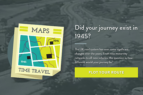
This got me thinking – what would my daily commute of cost me 60 years ago? I have often thought – how did people manage with the cost of the daily grind in the 1940s. Well I have good news – thanks to The Co-operative Insurance, they have come up with a neat little tool called Maps Time Travel.
You can visit the campaign for Co-op insurance called Maps Times Travel by clicking the link here:
The idea around it was to create a tool which would allow you to calculate how long and how much money your commute would have taken 60 years ago.
As you know, back in 1940s, there were no motorways – actually, the first motorway (The Preston by-pass) did not appear until 5th December 1958 and was officially Britain’s first stretch of motorway.
It was part of a planned north-south motorway system that included the spur to Blackpool and was just over 8 miles long, stretching from Bamber Bridge to Broughton and costing just under £3m.
The tool generates some interesting and cool facts. I did a quick check on my own daily commute where I take my children to school just outside my own home town.
There were some amazing results – showing that back in 1945 that same journey would have been 10 minutes longer and would have been three times the cost.
If You have some spare time and what to find out more of what it was like to travel back in time – then visit The Hub – It’s amazing what little bits of information you find out about not only your daily commute, but also how much it would of cost you to take you family on a seaside holiday back in 1940 compared to 2016. By Anthony Yates